
CALIFORNIA DRONE SERVICES
Unlock Your Farm's Potential
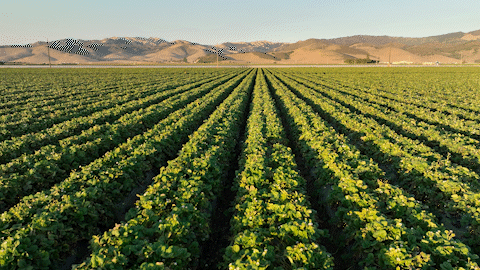
Agriculture drones can deliver real-time feedback on plant health, soil changes, irrigation issue, and site topography to maximize yield, reduce waste, and increase profits.
California Drone Services provides drone expertise that helps farmers and growers maximize their crop yields. We use the latest drone technology to provide accurate data and information to our clients. Our services range from precision mapping to plant health assessments, allowing us to provide tailored solutions for our clients’ needs.
We understand the importance of reliable and timely data, and strive to provide our clients with the best products and services available. Our commitment to excellence in all aspects of our services is what sets us apart from other providers in the industry.


HOW IT WORKS
We fly with multispectral cameras armed with Green, Red, Red Edge, and Near Infrared sensors. These sensors work together to support the NDVI, GNDVI, and NDRE vegetation indexes.
These indexes provide valuable insights for farmers. NDVI for example allows detection of plants experiencing stress, differentiation between crops, and identification of their growth stage. The NDRE index provides data about chlorophyll content in leaves, and the GNDVI is helpful for estimating photosynthetic activity, as well as water and nitrogen content in the plant canopy.
Multispectral imaging surveys can provide valuable insights for farmers.
The image above shows high chlorophyll levels for the same crop. Green is high levels, while red shows low levels.
Ag Drone Flights Can:
• Find water leaks and unproductive areas
• Gaps in seed and fertilizer coverage
• Map your property in 3D to visualize draining
• Measuring areas including volume, area, distance
• See crops under stress, or compare with other areas
• Document predators and target solutions
• Help manage livestock populations
• Show changes over time to your crops and property
• Enable precision spraying
• Reduce costs and increase yields with powerful data


Precision Agriculture
In flight centimeter-level accuracy can greatly enhance the precision of your land leveling, crop spraying, multispectral data collection, and harvesting line optimization. This can lead to improved insights and more detailed planning, ultimately resulting in increased efficiency and reduced errors across daily operations.
